
Henrietta
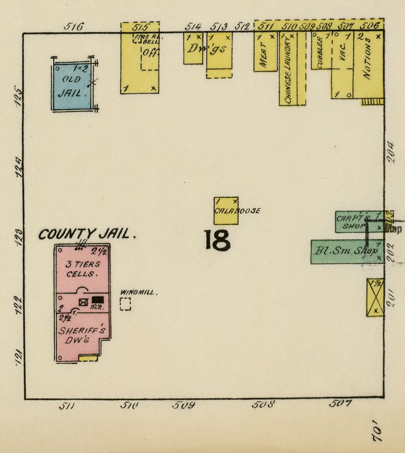
The first Sanborn map for Henrietta, Texas was published in March of 1885. Sheet 1 depicts a two-story wood calaboose in the northwest corner of city block 18. In the northeast corner of the same block was a stone jailer’s residence with cells. Since there is no Sanborn map prior to 1885 it is not known which of these jails were built and used first. In 1891 (Sheet 1), the stone jail is referred to on the map as the “old jail,” A new brick county jail had replaced the wooden calaboose and a smaller wooden calaboose stood in the middle of the block. This calaboose was probably used as a temporary facility while the new county jail was being erected. It was still there in 1896 (Sheet 2) and the old stone jail had become a Chinese laundry. There is a wooden building in the approximate area in 1902 (Sheet 5) but it is not labeled as a calaboose. In 1907 (Sheet 2) there was a calaboose in that same area with the address 817 1/2 Graham Street. It was still there in 1912 (Sheet 10). In 1922 (Sheet 2) it had been moved (or rebuilt) to another part of city block 18 facing an alley to the west and between the county jail to the west and city hall to the east. The 1922 Sanborn map was the last one available at the time of this research.

Henrietta 1885

Henrietta 1891

Henriett 1896

Henrietta 1907

Henrietta 1922